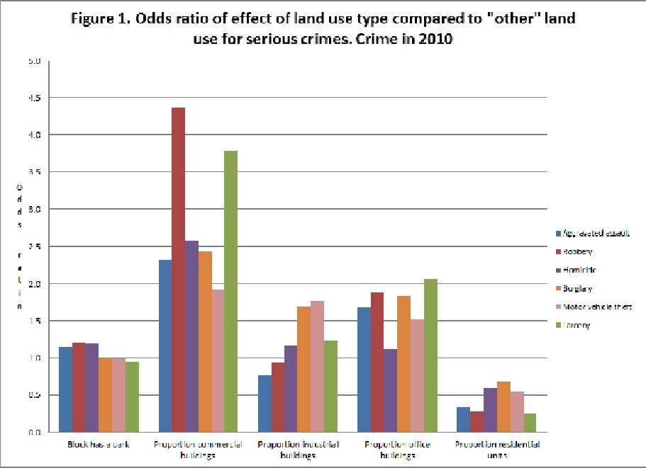
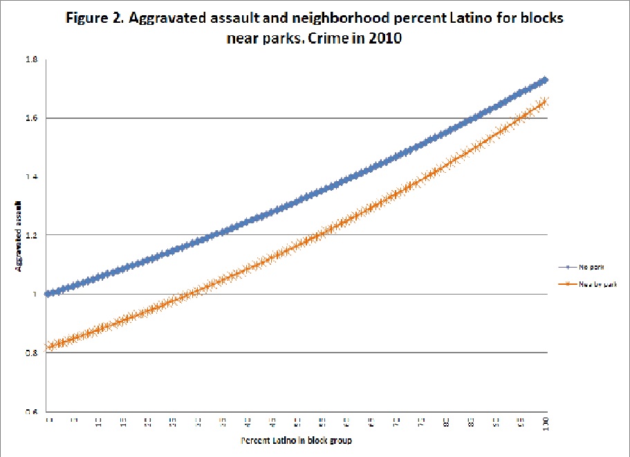
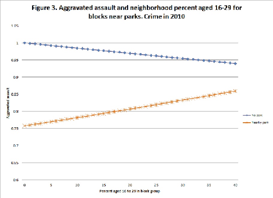
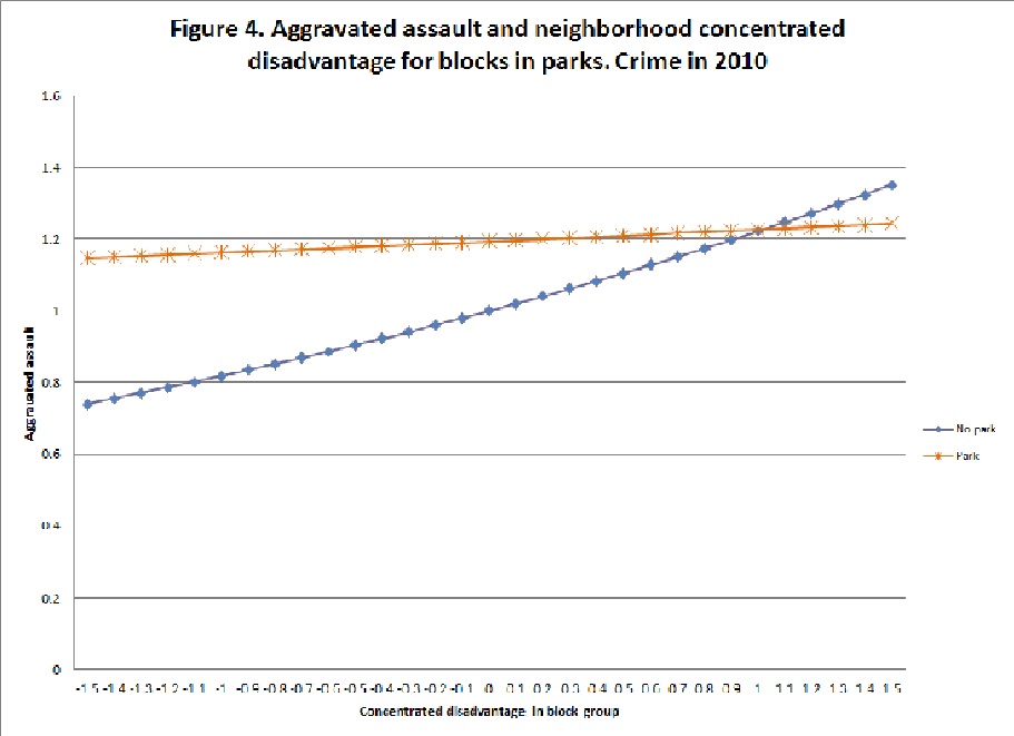
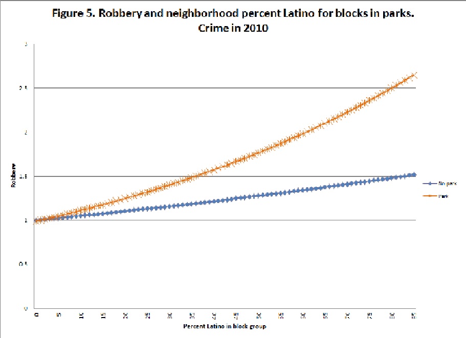
Although neighborhood studies often focus on the presence of some particular entity and its consequences for a variety of local processes, a frequent limitation is the failure to account more broadly for the local context. This paper therefore examines the role of parks for community crime, but contributes to the literature by testing whether the context of land use and demographics nearby parks moderate the parks and crime relationship. A key feature of our approach is that we also test how these characteristics explain crime in the park, nearby the park, and in other neighborhoods in the city with data from nine cities across the United States (N= 109,808 blocks). We use multilevel Poisson and negative binomial regressions to test our ideas for six types of street crime. Our findings show that nearby land uses and socio-demographic characteristics are a key driver of crime being located within the park or nearby the park. Our results also show a clear distance decay pattern for the impact of various land uses and socio-demographics nearby parks. The results emphasize a need for research to consider the broader socio-spatial context in which crime generators/inhibitors are embedded.
You can access the article by Dr. Adam Boessen and Dr. John R. Hipp in Social Science Research entitled, “Drugs, Crime, Space, and Time: A Spatiotemporal Examination of Drug Activity and Crime Rates”.
Get it here: https://www.sciencedirect.com/science/article/pii/S0049089X18301303
Abstract:
Although neighborhood studies often focus on the presence of some particular entity and its consequences for a variety of local processes, a frequent limitation is the failure to account more broadly for the local context. This paper therefore examines the role of parks for community crime, but contributes to the literature by testing whether the context of land use and demographics nearby parks moderate the parks and crime relationship. A key feature of our approach is that we also test how these characteristics explain crime in the park, nearby the park, and in other neighborhoods in the city with data from nine cities across the United States (N= 109,808 blocks). We use multilevel Poisson and negative binomial regressions to test our ideas for six types of street crime. Our findings show that nearby land uses and socio-demographic characteristics are a key driver of crime being located within the park or nearby the park. Our results also show a clear distance decay pattern for the impact of various land uses and socio-demographics nearby parks. The results emphasize a need for research to consider the broader socio-spatial context in which crime generators/inhibitors are embedded.